NavMonPc
A Windows Program for the
Display, Capture, and Playback of NMEA data.
New
Dials
Starting with Version 0.40
there are
some
new dial features. These are:
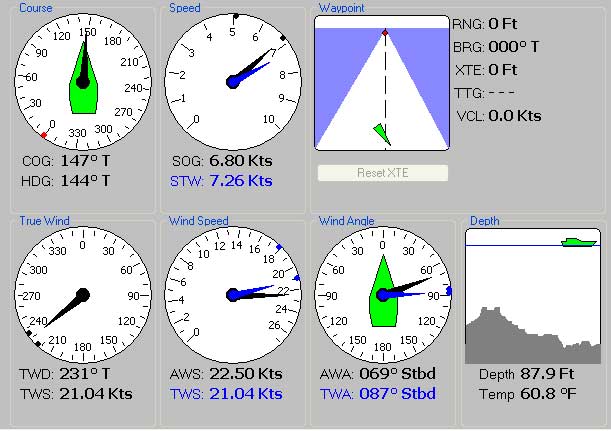
New True Wind dial
- TWD has been removed from
the Wind
Angle dial.
- TWS is now displayed both here and on the Wind
Speed dial
Redesigned Depth dial
- Shows time-chart of previous depth values (approximately 4-1/2 minutes
of history)
- There is a "Depth Caution" value. If the water is shallower than this,
the Depth dial background will turn yellow.
- The Depth display auto-scales. If the current depth is less than the
Caution value (or less than ten feet), the depth scale is fixed at this value
to avoid creating a false sense of secutity.
- Click on the Depth dial to access the depth alarm, depth caution, and depth
offset values.
Maximum and Minimum dots on
the Speed, Wind
Speed, Wind Angle, and True Wind dials.
- Click on the dial to
select and reset these dots
- <Control>-Click on the
dial for a quick min/max reset
- The dots show the min/max values since the last reset.
- Speed:
Max/Min SOG, STW
- Course:
Max/Min COG, HDG
- Wind Speed:
Max/Min AWS, TWS
- Wind Angle:
Max/Min AWA, TWA
- Wind Direction: Max/Min
TWD
Range selection for
the Speed and Wind
Speed dials.
- Click on the dial to
select range
General dial rearrangement
for better functional grouping
User Waypoint list: save
and select.