Own Ship dimension entry and display
A Windows Program for the Display, Capture, and Playback of NMEA data.
Target Scaling and Display on the NavMonPc AIS Plotter
Own Ship dimension entry
and display
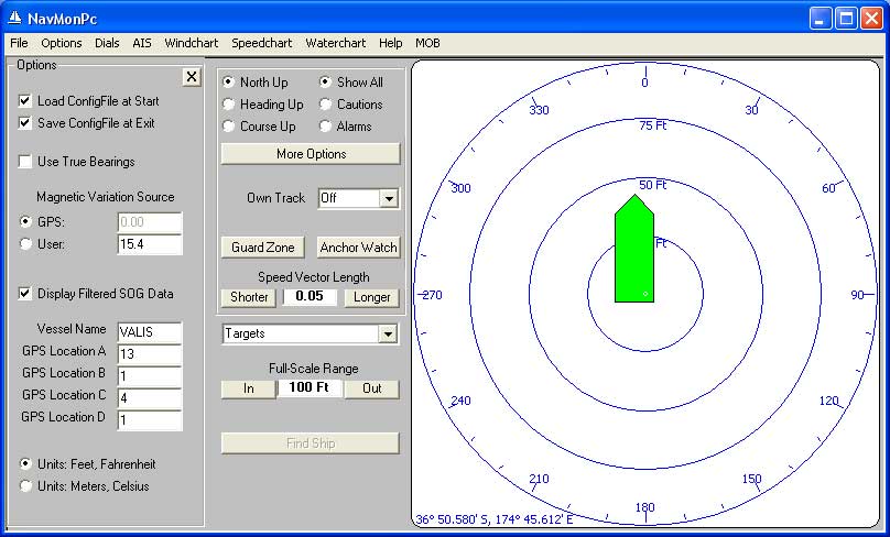
The Vessel Name and GPS Location fields are used to set the name of your vessel (used on the plotter display), and the location of your GPS antenna. This data is saved in the configuration file and is restored when the program is started.
The GPS Location fields are in units of meters, and are defined as follows:
When the AIS plotter is set to Plot to Scale (see AIS / More Options), these dimensions are used to accurately size and locate your vessel on the screen. Note that this data is only used within this program, and is not sent to your AIS transponder (should you have one).
All vessels that transmit an AIS signal must configure their AIS transponder with similar data. When the Plot to Scale option is selected all other ships will be displayed using their transmitted size and GPS location data. In most situations the scaled ship symbols would be too small to be displayed, and in this case a not-to-scale triangle is displayed instead. The following screenshots show the scaling option in use.
Here you can see the un-scaled display mode:
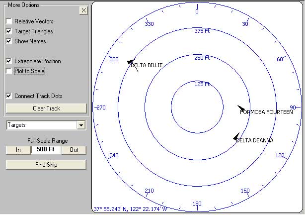
Targets displayed in not-to-scale
triangle format
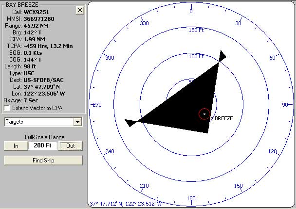
These same targets shown in scaled display mode provide a much clearer picture of what is going on: the two tugboats are assisting the much larger ship.
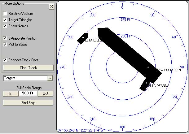
The same targets displayed
in scaled format
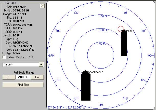
Note the small white dots at the locations of the GPS antennas on these ships. Click on the GPS location in order to see detailed ship data.
Ships with no GPS location
data, only length and beam
Some ships don't program the full dimensional data, only length and beam. In the case above, the GPS location is assumed to be on the port bow.
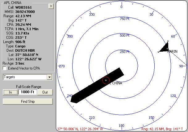
MARIN is
apparantly wider than it is long
Other ships may have incorrectly programmed AIS transponders -- or may perhaps actually be wider than they are long. In this case the displayed symbol can look quite strange.
A close-up of a wide (or
incorrectly programmed?) ship
This brings up an important point: Do not assume that a ship is displayed correctly! You really need to use your own eyes and own judgement.
Also note that CPA calculations are performed using only the location of a ship's (and your vessel's) GPS antenna. Please do not attempt a close-quarters interaction based solely on the displayed AIS data. You could pass well astern of a ship's GPS antenna, but still run into the ship (or worse). Don't let this happen to you:
.jpg)
Target Aging
Ships transmit their Class-A AIS data at various intervals, depending on their speed and rate-of-turn. Ships under way will transmit at least once every ten seconds, and as often as every two seconds. Moored ships will transmit every three minutes. Vessels equipped with Class-B AIS will transmit every five seconds to three minutes, but only if a radio timeslot is available (so some transmissions may be skipped). Both Class-A and Class-B transmissions may be lost or garbled due to interference or low signal-strength.
To indicate that the data from a displayed target has not been recently updated (and thus the position, etc, is suspect), targets that have "aged" longer than three minutes are "greyed" on the screen. This does not neecssarily indicate a problem, just that extra caution should be used when evaluating any collision potential.
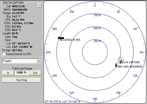
Aged target indication
In the screen above, data for the ship DELTA CAPTAIN has not been received for 467 seconds (see the Rx Age displayed in the vessel detail). Note the grey color, compared to the solid black of the nearby USNS CARL BRASHEAR. Vessels in an alarm state, but having aged, will also be greyed: for example, red will display as pink.
Note that the BRASHEAR, a Lewis and Clark-class dry cargo ship of the United States Navy, and which happens to be 689 ft long, has apparantly not programmed her length data.
Once a target has aged beyond ten minutes it will be removed from the display.